pyarchinit-photogrammetry
Open-source photogrammetry for archaeology and heritage BIM, integrated with PyArchInit.
From photos to georeferenced point clouds, meshes, DEMs and orthophotos, with the tools an
excavation needs: coded targets and ground control, sections and plans, contour lines and volumes,
stratigraphic units and spot heights with the fields of PyArchInit, pottery profiles, point classes,
Segment Anything 2.1, IFC export. A desktop application, a command line (ppg) and a Python
library on the same engine, running on the CPU (Apple Silicon included). GPL-2.0-or-later.
-
The desktop application for macOS and Windows, or
pip installon macOS, Windows and Linux (x86-64 and ARM). -
Step by step, with the demo project and with real photos of a tell.
-
Every menu, pane and tool of the window.
-
Documents, chunks and the workflow in scripts, also inside the window (Console Python).
-
Orthophotos, DEMs, models, units, spot heights and sections into a PyArchInit database.
-
Add menu actions, commands and export formats; the plugin repository.
What it does
- Reconstruction: alignment (COLMAP), depth maps (CPU, PatchMatch in Rust, or COLMAP/OpenMVS), dense cloud with confidence, mesh (Poisson, height field or depth map fusion), texture, DEM and orthophoto (true orthophoto, seamless blending, patches, at full resolution even on large tells).
- Georeferencing: ArUco/AprilTag targets found automatically, ground control and check points, scale bars, camera optimisation on the control, report with the errors.
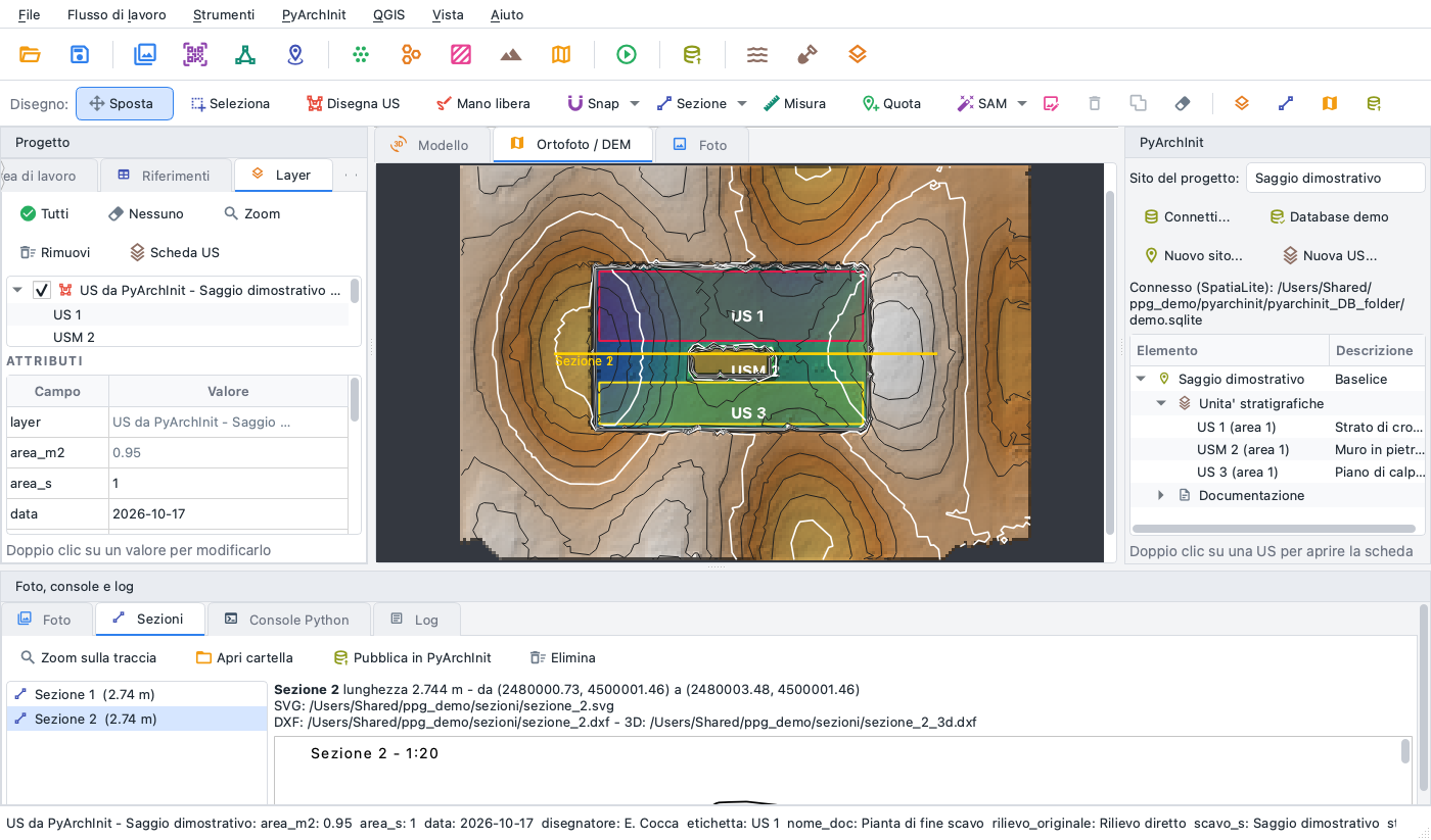
- Archaeology: sections and plans to scale (SVG/DXF), contour lines, cut and fill volumes, relief visualisations (sky-view factor, openness, multi-hillshade), stratigraphic units and spot heights drawn on the orthophoto, proposals of units and relationships, Munsell colours, pottery profiles from a turntable, stones and features with SAM.
- Exchange: PyArchInit (SQLite/SpatiaLite and PostgreSQL/PostGIS), QGIS live, QField, IFC 4, I3S scene layers, COPC, 3D Tiles, glTF; projects of Metashape, WebODM and Photo3D imported.
Status
Version 1.0 - desktop application, command line and library. The source, the issues and the releases are on GitHub; the plan of the next versions is in the roadmap.